Old Ordnance Survey One-Inch Maps


These maps are taken from the famous OS "Inch to the Mile" Maps. Though obviously far less detailed than the large scale maps for which we are perhaps better known, they provide an invaluable overview of a wider area, typically 18 miles across by 12 miles down. For transport historians they are invaluable for showing old railways, while all historians need them for their close depiction of topography, including parish boundaries. These maps also mean that we can offer historical coverage for small villages where a large scale map would not be commercially viable. We intend to publish the whole of England and Wales in this series. Almost 200 titles are now available and we aim to publish three new titles each month. The maps include historical notes and all (except the double-sided Tyneside title) also include a large scale map of a small town or village in the area.

The maps are neatly folded and each includes a specially written introduction to the area. Maps can be purchased on our On-line Mapshop where further information about titles is given. Visit the One Inch Page for a full list of Inch to the Mile Maps, or The Index Page for a full list to the series and details of Prices.

Here is information about Sheet 268:

  • One Inch Sheet 268 Mid Berkshire 1885 - published 1999; introduction by Christopher Board

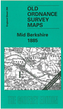
    This early Inch to the Mile map, which is centred on Reading, covers the central area of Berkshire, with smaller portions of Oxfordshire and Hampshire north and south. Coverage stretches from Hampstead Norris eastward to Wokingham, and from Streatley southward to Silchester and Stratfield Saye. These early maps are always attractive and the leafy nature of this area is most pleasing. On the reverse we include an extract from Berkshire Sheet 44.06 showing Aldermaston in 1898, complete with directory.


    It is not possible to list the many hamlets, farmsteads and other topographical features shown on these maps. However, you may find it useful if we list the towns and principal villages or church parishes that are included on this map. Links are given for those for which detailed large-scale maps are also available.

  • Berkshire: Aldermaston, Arborfield, Ashampstead, Barkham, Basildon, Beenham, Bradfield, Brimpton, Burghfield, Englefield, Finchampstead, Hurst, Padworth, Pangbourne, Purley Reading, Ruscombe, Shinfield, Sonning, Stanford Dingley, Stratfield Mortimer, Sulham, Sulhampstead Abbots, Sulhampstead Bannister, Tidmarsh, Tilehurst, Twyford, Ufton Nervet, Wargrave, Wasing, Wokingham.
  • Hampshire: Eversley, Silchester, Stratfield Saye.
  • Oxfordshire: Caversham, Goring, Mapledurham, Whitchurch.

    For a full list of Inch to the Mile maps go to the One Inch Page; or for local larger scale maps go to the Berkshire or Thames Valley page.

    You can order maps direct from our On-line Mapshop. For other information and prices, and other areas, go to The Index Page.


    The Godfrey Edition / godfreyedition@btinternet.com / 31 January 2006