Old Ordnance Survey Maps of Pangbourne


We have published more than 1,800 maps in our series of Old Ordnance Survey Map reprints, including groups in Berkshire & Oxfordshire. The maps are highly detailed. They are taken from the OS 1:2,500 (or 25 inch) maps and reduced to about 15 inches to the mile. Each covers an area of a mile and a half by a mile. They show streets with individual houses, tram tracks, railway tracks and even signals, factories, wharves and such details as fountains and water troughs. They will provide hours of fascination for historians and genealogists. The maps are neatly folded and each includes a specially written introduction to the area. Maps can be purchased on our On-line Mapshop where further information about titles is given. Or visit The Index Page for a full list to the series and details of Prices.


Here are the details of maps for Pangbourne:

  • Berkshire Sheet 28.12 Pangbourne & Whitchurch 1910 - published 2002; introduction by Jean Debney

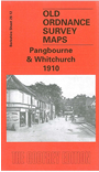
    This detailed map is split between Berkshire and Oxfordshire, with the River Thames forming the boundary. The main part of the map is for Pangbourne, in Berkshire, on the south side of the river. Coverage extends from the village and railway station eastward about a mile to Purley Hall and Mosshall Wood, and southward to Flower's Farm. Features include St James church, River Pang, Reading Road, Horseshoe Road, Home Farm, The Canal, Thames Avenue. The GWR runs west-east through the map and the station is near the western edge. Across the river is a small area of Oxon, covering just the village centre of Whitchurch, including St Mary's church, Thames Bank, Walliscote House. Further east is a parochial oddity, Saltney Mead, "Common to the Parishes of Sulham & Purley". Directories for both villages are on the back.

    You might find this index map useful.


    Follow this link for a complete list of our Berkshire Series maps.

    You can order maps direct from our On-line Mapshop. For other information and prices, and other areas, go to The Index Page.


    Maps in the Godfrey Edition are taken from the 25 inch to the mile map and reduced to about 15 inches to the mile. For a full list of maps for the Berkshire area, return to the Thames & Chilterns page.

    The Godfrey Edition / godfreyedition@btinternet.com / 10 November 2005