
Old Ordnance Survey Maps of Berkshire
We have a range of detailed maps for Berkshire towns and we also cover the whole county at the Inch to the Mile scale.
Here are the details.
All maps are available from our On-line Mapshop.
Berkshire County Council was formed in 1889. There was a reorganisation in 1974, with a county council and 6 Districts; Abingdon, Didcot and Wantage were vtransferred to Oxfordshire, while
Eton and Slough were transferred from Buckinghamshire to Berkshire.
Further reoganisation in 1998 saw Berkshire County Council abolished. The county is now divided between 6 unitary authorities:
Bracknell Forest, Reading, Slough, West Berkshire, Windsor & Maidenhead, and Wokingham..
See This Page for a summary of the county's local government history.
 These are the maps we publish for Berkshire:
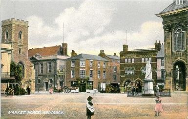
10.06 Abingdon 1910 - published 2003; intro by Barrie Trinder
15.07 Didcot 1898 - published 2014; intro by Michael Jee
24.14 Maidenhead 1897 - published 1994; intro by Edward Sammes
24.15 Maidenhead Bridge & Taplow 1897 - published 1995; intro by Edward Sammes
28.12 Pangbourne & Whitchurch 1910 - published 2002; intro by Jean Debeney
32.09 Windsor 1897 - published 1993; intro by Judith Hunter
32.10 Windsor Castle & Datchet 1897 - published 1994; intro by Judith Hunter
37.03a Reading 1877 - published 2015; intro by Tony Painter  37.03b Reading 1898 - published 1994; intro by R B Parry
38.15 Wokingham 1909 - published 2004; intro by Barrie Trinder
39.16 Ascot 1910 - published 2005; intro by Tony Painter
43.01 Newbury 1898 - published 2000; intro by Tony Higgott
37.03b Reading 1898 - published 1994; intro by R B Parry
38.15 Wokingham 1909 - published 2004; intro by Barrie Trinder
39.16 Ascot 1910 - published 2005; intro by Tony Painter
43.01 Newbury 1898 - published 2000; intro by Tony Higgott
The following Buckinghamshire towns are now in Berkshire:
Bucks 56.02 Slough 1897 - published 1993; intro by Judith Hunter
Bucks 56.05 Eton & Eton Wick 1899 - published 1994; intro by Judith Hunter
The following are taken from the 'Five-foot' Town Plans, which are extremely detailed. We reduce them to a scale of 'A Yard to the Mile':
32.53 Windsor (North) 1868 - published 2011; intro by Pamela Taylor
32.63 Windsor (South) 1868 - published 2011; intro by Pamela Taylor
We also cover the whole of Berkshire in our Inch to the Mile series. Here are the principal sheets for the county:
253 Vale of White Horse 1893 - published 2002; intro by Tony Higgott. Includes a map of Faringdon
255 South Chilterns 1886 - published 1997; intro by Elizabeth Lockwood. Includes a map of Chalfont St Peter
267 SW Berkshire 1889 - published 1999; intro by Tony Higgott. Includes a map of Ramsbury
268 Mid Berkshire 1885 - published 1999; intro by Christopher Board. Includes a map of Aldermaston
269 Windsor Forest & District 1897 - published 1998; intro by Christopher Board. Includes a map of Stanwell
Visit the One Inch page for further details on this series.
 Most maps in the Godfrey Edition are taken from the 25 inch to the mile map and reduced to about 15 inches to the mile.
For some adjacent counties go to the Chilterns page.
For a full list of English maps, return to the England page
You can order maps direct from our On-line Mapshop.
This list shows all our maps for the county. We try to keep a full range in print but inevitably some titles fall out of print from time to time.
These are noted in our On-line Mapshop.
Most maps in the Godfrey Edition are taken from the 25 inch to the mile map and reduced to about 15 inches to the mile.
For some adjacent counties go to the Chilterns page.
For a full list of English maps, return to the England page
You can order maps direct from our On-line Mapshop.
This list shows all our maps for the county. We try to keep a full range in print but inevitably some titles fall out of print from time to time.
These are noted in our On-line Mapshop.
Alan Godfrey Maps, Prospect Business Park, Leadgate, Consett, DH8 7PW. Tel 01207 583388
The Godfrey Edition / sales@alangodfreymaps.co.uk / 7 October 2016
 These are the maps we publish for Berkshire: