Old Ordnance Survey Maps of Reading


We have published more than 1,800 maps in our series of Old Ordnance Survey Map reprints, including a group in Berkshire. The maps are highly detailed. They are taken from the OS 1:2,500 (or 25 inch) maps and reduced to about 15 inches to the mile. Each covers an area of a mile and a half by a mile. They show streets with individual houses, tram tracks, railway tracks and even signals, factories, wharves and such details as fountains and water troughs. They will provide hours of fascination for historians and genealogists. The maps are neatly folded and each includes a specially written introduction to the area. Maps can be purchased on our On-line Mapshop where further information about titles is given. Or visit The Index Page for a full list to the series and details of Prices.


Here are the details of maps for Reading:
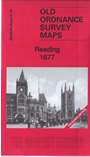
  • Berkshire Sheet 37.03 Reading 1898 - published 1994; introduction by R B Parry

    This detailed map covers much of the town of Reading, whose population grew from 21,456 in 1850 to 72,217 in 1900. Coverage stretches from Brunswick Street and Argyle Street eastward to Craven Road, and from the railway southward toWaldeck Street and Berkeley Avenue. The important railway station is near the top of the map but is here shown in an interesting state of confusion, as it was being enlarged at the time. Most of the GWR tracks are therefore without platforms, although the adjacent SER terminus is complete. The Oxford Road / Broad Street runs west-east through the map, with tramway. Other features include most of the town centre, London Street, Castle Street, St Mary's church (in the centre of the map), River Kennet with many riverside works and wharves, Kennet & Avon Canal, Seven Bridges Brewery, Royal Albert Brewery, Royal Berkshire Hospital, Municipal Buildings, Huntley & Palmer's biscuit factory with rail connections, St Giles church, part of the GWR railway works, Royal Berkshire Seed Establishment, site of Abbey remains, prison (left blank as usual but famous as temporary home to Oscar Wilde), Ascham House. Near the western edge of the map is All Saints church.

    You might find this index map useful.


    Follow this link for a complete list of our Berkshire Series maps.

    You can order maps direct from our On-line Mapshop. For other information and prices, and other areas, go to The Index Page.


    Maps in the Godfrey Edition are taken from the 25 inch to the mile map and reduced to about 15 inches to the mile. For a full list of maps for the Berkshire area, return to the Thames & Chilterns page.

    The Godfrey Edition / godfreyedition@btinternet.com / 9 November 2005