
 Here is information about Sheet 236:
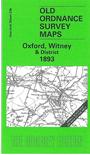
This Inch to the Mile map covers the area of Oxfordshire centred on Witney. Coverage extends from Burford eastward to Oxford itself, and from Charlbury southward to Appleton. The Oxford, Witney & Fairford railway runs through the map, and other features include Eynsham Park, Woodstock Great Park and Blenheim Palace, Wytham Park, the River Thames or Isis, Cokethorpe Park, Cornbury Park and Wychwood Forest, and the rivers Cherwell and Windrush. On the reverse we include an extract from Oxfordshire Sheet 26.12 covering the small village of Bladon, together with a directory.
It is not possible to list the many hamlets, farmsteads and other topographical features shown on these maps. However, you may find it useful if we list the towns and principal villages or church parishes that are included on this map:
Index maps are available showing the areas covered by the Inch to the Mile maps. Go to This page
You can order maps direct from our On-line Mapshop. For a full list of Inch to the Mile maps go to the Inch to the Mile page, where you will also find details of prices. For information on the rest of the series, go to The Index Page.