
 Here are the details of maps for Oxford:

We have published two detailed maps of Oxford. These link up with each other to provide quite good coverage of the city, though some outlying areas, including the station, are not yet covered.
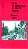
The map simply called Oxford covers the centre and north of the city, coverage stretching from Parkend Street and the LNWR station (on the margin of the map) eastward to New Marston, and from Church Street and Pembroke Street northward to Norham Gardens. Features include most of the Colleges, including Balliol, Jesus, Exeter, Trinity, St Johns,Worcester, Somerville, Keble, Christ Church (at the foot of the map), All Souls, Corpus Christi, Merton, Queen's, All Souls, Madgalen, St Edmund Hall, Wadham, Mansfield. Other features include Magdalen Bridge, Botanic Gardens, St Clement's church, River Cherwell, Mesopotamia Walk, Radcliffe Library, Radcliffe Observatory, County Hall, Cornmarket Street, Clarendon Press, St Giles Street, St Giles church, Radcliffe Infirmary. Tramways are shown. We have revised the directory extracts for the 2015 revision.
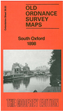
The South Oxford map continues coverage south, covering an area from Pembroke College a mile southward to New Hinksey, and from the Hinksey Stream eastward to Hurst Street. Features include the Cathedral, New Street, Folly Bridge, Trinity church, St Matthew's church, Grandpont,Abingdon Road. The Thames or Isis runs through the centre of the map and east of that are the University Running Ground, St Hilda's, Donnington Nursery, Iffley Road, St John's church, Christchurch Meadow, Bullingdon Road, tramways. Street directories for Abingdon Road, Black Friars Road, Cambridge Street, Friars Street, Friars Wharf, Iffley Road, Isis Street, St Aldgate's Street, Speedwell Street are on the back.