We have published more than 1,800 maps in our series of Old Ordnance Survey Map reprints, including a group in Oxfordshire. The maps are highly detailed. They are taken from the OS 1:2,500 (or 25 inch) maps and reduced to about 15 inches to the mile. Each covers an area of a mile and a half by a mile. They show streets with individual houses, tram tracks, railway tracks and even signals, factories, wharves and such details as fountains and water troughs. They will provide hours of fascination for historians and genealogists. The maps are neatly folded and each includes a specially written introduction to the area. Maps can be purchased on our On-line Mapshop where further information about titles is given. Or visit The Index Page for a full list to the series and details of Prices.
Here are the details of maps for Burford & Fulbrook:
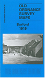
This detailed map of Burford is double-sided to provide maximum coverage. The main map covers the northern part of the town centre, from Sheep Street northward, with coverage extending north to Fulbrook, west to Upton and Kitt's Quarries. Features include the River Windrush, St John the Baptist church, Priory, northern part of High Street, cottage hospital, Westhall Hill; and at Fulbrook, St James church, Masons Arms pub. On the reverse is a section of sheet 30.04 extending coverage south and including the rest of High Street, police station, Bury Barns.
Follow this link for a complete list of our Oxfordshire Series maps.
You can order maps direct from our On-line Mapshop. For other information and prices, and other areas, go to The Index Page.
Maps in the Godfrey Edition are taken from the 25 inch to the mile map and reduced to about 15 inches to the mile. For a full list of maps for the Oxfordshire area, return to the Thames & Chilterns page.
The Godfrey Edition / godfreyedition@btinternet.com / 28 November 2005