
 Here is information about Sheet 176:
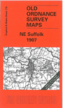
This One Inch to the Mile map straddles the border between Norfolk and Suffolk, though covering rather more of the southern county. Coverage stretches from Homersfield station eastward to the coast, and from Lowestoft southward to Southwold. On the reverse is a detailed map of the village of Wrentham, complete with directory. Several towns are on the map: Lowestoft, Beccles, Bungay, Southwold and Halesworth, along with numerous small villages, including the complicated Ilketshall and South Elmham parishes.
It is not possible to list the many hamlets, farmsteads and other topographical features shown on these maps. However, you might find it useful if we here list the majority of the principal villages and church parishes that are included on this map. Links are given for those for which detailed large-scale maps are also available.
Index maps are available showing the areas covered by the Inch to the Mile maps. Go to This page
You can order maps direct from our On-line Mapshop. For a full list of Inch to the Mile maps go to the Inch to the Mile page, where you will also find details of prices. For information on the rest of the series, go to The Index Page.