Old Ordnance Survey Maps of Nottingham (N)


We have published more than 2,300 maps in our series of Old Ordnance Survey Map reprints, including a group in Nottinghamshire. The maps are highly detailed. They are taken from the OS 1:2,500 (or 25 inch) maps and reduced to about 15 inches to the mile. Each covers an area of a mile and a half by a mile. They show streets with individual houses, tram tracks, railway tracks and even signals, factories, wharves and such details as fountains and water troughs. They will provide hours of fascination for historians and genealogists. The maps are neatly folded and each includes a specially written introduction to the area. Maps can be purchased on our On-line Mapshop where further information about titles is given. Or visit The Index Page for a full list to the series and details of Prices.


Here are the details of maps for Nottingham (North):

  • Notts Sheet 38.14 Nottingham (North) 1913 - published 2003; introduction by Ronald Blake

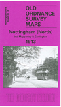
    This very detailed map covers the north part of Nottingham, including the Carrington area, much of Mapperley and Alexandra Park. Coverage stretches from Exeter Road eastward to The Wells Road, and from St Ann's Hill northward to Percival Road.

    Features include Forest House, tramways, Carrington station, Sherwood Hill Works, Forest Recreation Ground, Bellevue Reservoir, St John's church, Hungerhill Gardens, Stonepit Coppice Gardens, Alexandra Park area, Lunatic Asylum, Mapperley Hall, St Jude's church, Carrington Market Place etc. On the reverse we include street directory entries for Magdala Road, Redcliffe Road, Private Road, Sherwood Rise, Woodborough Road in 1902.

    The map links up with Notts sheet 38.13 Nottingham NW to the west and 42.02 Central Nottingham to the south.

    You might find this index map useful.


    Follow this link for a complete list of our Nottinghamshire Series maps.

    You can order maps direct from our On-line Mapshop. For other information and prices, and other areas, go to The Index Page.


    Maps in the Godfrey Edition are taken from the 25 inch to the mile map and reduced to about 15 inches to the mile. For a full list of maps for the East Midlands, return to the East Midlands page.

    The Godfrey Edition / godfreyedition@btinternet.com / 28 October 2009