
 Here are the details of maps for Old Basford:

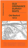
This very detailed map covers Old Basford, with coverage from Christ Church Cinderhill eastward to Bagthorpe Hospital, and from Basford Workhouse southward to Church Street.
Features include Old Basford with individual buildings neatly shown, tramways, Vernon Park; numerous railways including Midland Railway Nottingham & Mansfield line with Basford station, Cinderhill Branch, Basford Junction, GNR railway Derbyshire & Staffordshire line with Basford & Bulwell station, Basford East Junction, Bagthorpe Curves, Leen Valley line, GCR line with carriage sheds; Bagnall House, Bagnall Dye Works, Basford Union Workhouse, Basford Hall, Bleach Works, Iron Works, chapels etc. A selection of street directory entries, incl Church Street, Lincoln Street and Vernon Road, is included on the reverse.
The map links up with Notts sheets 38.05 Bulwell to the north, 38.10 Sherwood to the east, 38.13 Nottingham NW to the south.