Old Ordnance Survey Maps of Nottinghamshire

  • These detailed maps normally cover an area of about one and a half miles by one mile. Each map includes an introduction.
  • They are available through our On-line Mapshop

  • Here are the details of maps for Bulwell:

  • Notts Sheet 38.05 Bulwell 1913 - published 2013; intro by Barrie Trinder. ISBN.978-1-84784-662-4

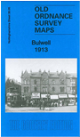
    This very detailed map covers the centre and eastern side of Bulwell.

    Features include Main Street area, Market Place, St Mary's church, Midland Railway with Bulwell station, Forest Side area, Forest Works, Highbury Vale area, Great Central Railway with Bulwell Common station, Bulwell North and South junctions, GNR railway with Bulwell Forest station and wagon works. Street directory extracts are included on the reverse.

    The map links up with Notts sheets 37.08 Bulwell (West) to the west, 38.06 Arnold to the east, 38.09 Old Basford to the south and 38.01 Bestwood Colliery to the north.


  • Follow this link for a complete list of our Nottinghamshire Series maps.
  • You can order maps direct from our On-line Mapshop. For other information and prices, and other areas, go to The Index Page.
  • Maps in the Godfrey Edition are taken from the 25 inch to the mile map and reduced to about 15 inches to the mile. For a full list of maps for the East Midlands, return to the East Midlands page.
    The Godfrey Edition / sales@alangodfreymaps.co.uk / 29 January 2022