
 Here are the details of maps for Irlam & Cadishead:

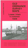
This detailed map covers Lower Irlam, with coverage then running along the Liverpool Road towards Cadishead; Green Lane and Lords Street are at the foot of the map. The major feature on the map is the massive Partington Steel & Iron Works, with its many sidings, and the map also has a stretch of the Manchester Ship Canal, with sidings leading to wharves or bunkering facilities. Other features on the map include stretches of the Cheshire Lines Railway with Irlam and Cadishead stations, Glazebrook Exchange Sidings, Glazebrook Hall, St Mary's church, Wallpaper works, engineering works, Higher Stanley Bank Farm, other farms along Moss Road. On the reverse we include 1918 directories for Irlam, Cadishead and Chat Moss.
The map links up with Lancashire Sheets 110.01 Irlam Hall to the north, 110.06 Carrington to the east and 110.09 Partington to the south.