
 Here are the details of maps for Irlam:

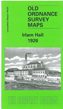
Here we give you two detailed maps, to show how the area developed across the years. The main map is the 1926 version and covers an area from Moss Road and Cadishead Moss eastward to Liverpool Road. Most development is at the eastern part of the map, features including Jenny Green, the Co-op Soap and Candle Works, Fairhills Road, Irlam Hall, and the northern part of Lower Irlam. West of this development is Cadishead Moss and here a surprising feature is the tramway network running across it for the carriage and disposal of manure and other refuse. On the reverse we include a large part of the earlier 1904 revision, showing the Jenny Green and Irlam Hall area before further development.
This map links up with Sheets 110.02 Flixton to the east and 110.05 Lower Irlam to the south.