
 Here are the details of maps for Gorton:


We have published four versions of this map, showing how the area changed across the years. The 1890 version is in full colour, taken from the beautiful 1st Edition OS handcoloured map.
These detailed maps cover the area of SE Manchester around Belle Vue, extending eastward to Gorton. Coverage stretches from Slade Lane eastward to Hyde Road station, and from Hector Street northward to Great Jackson Street.
Features include Belle Vue Zoological Gardens, Nutsford Vale, St Cyprian's church, Kirkmanshulme House, football ground, Imperial Brewery, tramways, Tarpaulin Works, sewage works, Catsknowl, Gorton Park, railway stretches with Belle Vue station, St Philip's church, Unitarian church, Rider Brow, Spring Hill Farm, Sunny Brow Park, St James church, Gorton Mills, Victoria Works etc. We include extracts from early street directories on the reverse of each map.
The map links up with sheets 104.12 Openshaw to the north, 104.15 Victoria Park to the west, 105.13 Denton West to the east and 111.04 Levenshulme to the south.
Further information:
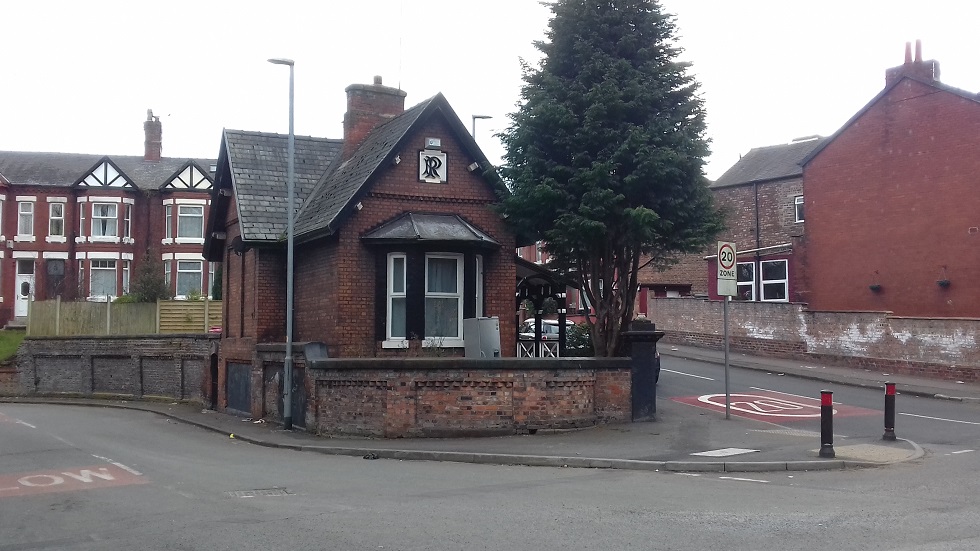
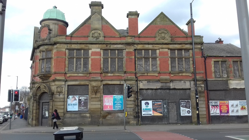
Gorton lies in the historic Manchester parish but had an independent Local Board and then Urban District Council from 1863 to 1909. Industry arrived with the Gorton Mills and (north of this map) major railway engineering works. The village's skyline was (and is) dominated by the spires of two fine churches, sponsored in friendly rivalry by the railway engineers Charles Beyer and Richard Peacock; the latter lived at Gorton Hall and would be buried in a handsome mausoleum at the Brookfield Church. Further west we enter Kirkmanshulme, a detached area of Newton, and here John Jennison established his Belle Vue Gardens in 1837, developing it into a major entertainment centre: a zoo, concert hall, fireworks displays, greyhound racing and speedway would all entice Mancunians out on the tramways and railways shown on these maps. Scarcely a stone's throw away a grim prison glowered over the townscape until 1890. These four maps follow the area's transfiguration from a semi-rural landscape of Victorian England to the busy urban area we know today, though fragments of the old Gorton still survive.


 .
.
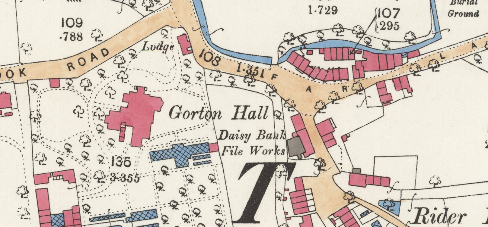
....."Belle Vue Gardens are far from the complete recreational story of this map and as house-building began to spread across the area, there was pressure to retain some areas as parkland for local people. The southern part of the map appears quite open, but development was always likely to spread eastward from the Stockport Road. The small Crowcroft Cotton Mill that appears on the 1848 map had been reduced to a farm, while the days of Crowcroft House as a country residence in leafy grounds were almost over. In 1900 Manchester Corporation acquired the site from the Dean and Canons of Manchester for Ł520 a year, and quickly laid out a park, opened in 1905, with tennis courts and bowling greens. The house itself was demolished in the 1920s. Earlier, to the north of Hyde Road in plots 24 and 43, Gorton Park was opened in 1893. Local sporting events were also staged elsewhere, and in 1843 many spectators gathered in the Coffin Field, Pink Pank Lane, to watch a ‘scientific prize fight’ between Bulliver and Elijah Charlesworth. Bulliver won and Charlesworth, perhaps falling on hard times, was later transported".....