
 Here are the details of maps for Walkden (S):

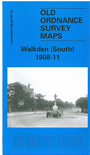
This detailed map covers the southern half of the Lancashire town of Walkden, west of Salford. Coverage stretches from Ellenbrook station eastward to Old Clough Lane and northward to the Manchester Road and Wardley Street. Features include a stretch of the LYR Pendleton & Hindley railway with Walkden station, a stretch of the LNWR Worsley & Bolton line with Walkden station, a stretch of the LNWR Eccles-Wigan line with Ellenbrook station, Walkden Yard, Ellesmere Colliery, Wardley Mill, Linnyshaw Reservoir, Linnyshaw Mill, St Paul's church, Stocks Hotel, tramways, Lady Ellesmere Memorial, Parr Fold Park, Edge Fold, Bridgewater Collieries Railway with various spurs, Mather's Fold, Engine Fold, Primrose Bank etc. On the reverse we include 1889 and 1929 timetables for the LNWR Manchester-Bolton line.
The map links up with sheets 95.10 Walkden North to the north, 95.13Cleworth Hall to the west, 95.15 Wardley to the east and 103.02 Worsley Hall to the south.