We have published more than 2,100 maps in our series of Old Ordnance Survey Map reprints, including a large group in Lancashire. The maps are highly detailed. They are taken from the OS 1:2,500 (or 25 inch) maps and reduced to about 15 inches to the mile. Each covers an area of a mile and a half by a mile. They show streets with individual houses, tram tracks, railway tracks and even signals, factories, wharves and such details as fountains and water troughs. They will provide hours of fascination for historians and genealogists. The maps are neatly folded and each includes a specially written introduction to the area.
Maps can be purchased on our On-line Mapshop where further information about titles is given. Or visit The Index Page for a full list to the series and details of Prices.
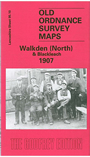
Here are the details of maps for Walkden (North):
This detailed map covers the northern part of Walkden, with coverage extending from Chatsworth Street northward to Blackleach Sewage Works, and from Sod Hall on Cleggs Lane eastward to Linnyshaw Moss. Features include Little Hulton station, Walkden Mills, Primrose Mill, Park Mill, Granville Mill, St John the Baptist church, Hill Top, Kearsley Chemical Works, Kearsley Moss Colliery, several stretches of the Bridgewater Collieries Railway, tramways, Ashton's Field Colliery, Buckley Lane End, Blackleach Reservoir.A Walkden directory is included on the reverse.
The map links up with Lancashire Sheets 95.06 Farnworth to the north, 95.09 Little Hulton to the west, 95.11 Kearsley to the east, and 95.14 Walkden South to the south.
Follow this link for a complete list of our Bolton maps or here for Salford maps.
You can order maps direct from our On-line Mapshop. For other information and prices, and other areas, go to The Index Page.
Maps in the Godfrey Edition are taken from the 25 inch to the mile map and reduced to about 15 inches to the mile. For a full list of maps for the North West, return to the North West page.
The Godfrey Edition / godfreyedition@btinternet.com / 28 December 2007