
 Here are the details of maps for Hindley Green:

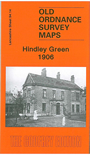
This detailed map covers much of Hindley Green, with coverage stretching from the Atherton Road southward to Tamer Lane End, and from Bickershaw Hall Farm eastward to Pickley Green.
Features include railway with Hindley Green station, Springs Pit, Engine Pit, Hindley Green Hall, St James & St Elizabeth church at Bickershaw, St John's church, St Paul's church at Pickley Green, part of Westleigh (in bottom right corner), Tamer Lane End, Dangerous Corner, mineral lines, Carr Common Colliery, old shafts, Stonehouse Colliery. On the reverse we include a 1918 Hindley Green directory.
The map links up with Lancashire sheets 94.10 Hindley Green (N) to the north, 94.13 Platt Bridge to the west, 94.15 Atherton SW to the east and 102.02 Westleigh to the south.