Old Ordnance Survey Maps of Hindley (E)


We have published more than 2,400 titles in our series of Old Ordnance Survey Map reprints, including a large group in Lancashire and several around Wigan. The maps are highly detailed. They are taken from the OS 1:2,500 (or 25 inch) maps and reduced to about 15 inches to the mile. Each covers an area of a mile and a half by a mile. They show streets with individual houses, tram tracks, railway tracks and even signals, factories, wharves and such details as fountains and water troughs. They will provide hours of fascination for historians and genealogists. The maps are neatly folded and each includes a specially written introduction to the area. Maps can be purchased on our On-line Mapshop where further information about titles is given. Or visit The Index Page for a full list to the series and details of Prices.


Here are the details of maps for Hindley (East):

  • Lancashire Sheet 94.10 Hindley Green (North) 1907 - published 2010; intro by Alan Godfrey

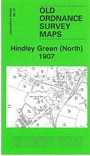
    This highly detailed map covers the northern part of Hindley Green, together with the southern fringe of Westhoughton. Coverage stretches from Hindley Green Mills northward and eastward to Eatock's Colliery.

    Features include Eatock's Colliery, Brookside or Bugle Horn Colliery, Swan Nut & Bolt Works, mineral railways, Hindley Green Mills, tramway, Long Lane Farm, old shafts, Carr Common, The Pungle, Westhoughton Mills (disused), Hosker's Nook, Southworth House etc.

    On the reverse we include an extract from the 1929 version, showing the area around Brookside Colliery at a later stage. This map includes a reopened Swan Lane Colliery.

    The map links up with sheets 94.09 Hindley to the west, 94.14 Hindley Green to the south.


    Follow this link for a complete list of our Wigan area maps or St Helens area maps.

    You can order maps direct from our On-line Mapshop. For other information and prices, and other areas, go to The Index Page.


    Maps in the Godfrey Edition are taken from the 25 inch to the mile map and reduced to about 15 inches to the mile. For a full list of maps for the North West, return to the North West page.

    The Godfrey Edition / godfreyedition@btinternet.com / 2 June 2010