
 Here are the details of maps for Kensington:

We have published three versions of this map, showing how the area developed across the years. The maps each cover the same area, stretching from Hornton Street to Cadogan Square, from Kensington Palace southward to Harrington Road. The Royal Albert Hall is in the centre of the map and other major features include The Serpentine, Natural History Museum, Brompton Road, Imperial Institute, Cromwell Road, Hyde Park Barracks; South Kensington, Gloucester Road and Kensington High St stations; Victoria & Albert Museum; St Margaret & St John's Workhouse; Royal Horticultural Gardens (on 1871 map), Kensington Gardens, Kensington Palace, Knightsbridge. The Kensington 1894 map was our first ever title in London.
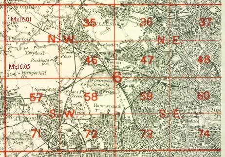
The map links up with London Sheets 60 Paddington to the north, 73 Holland Park to the west, 75 Westminster to the east and 87 Chelsea to the south.
 Follow this link for a complete list of our London maps .