
 Here are the details of maps for Wrexham :

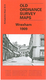
This detailed map is our main title for Wrexham. It covers most of the town centre, with coverage stretching from Bradley Road eastward to The Dunks and Hafod-y-wern, and from Grosvenor Road southward to King's Mills. Features include Central station, St Giles church, Hope Street, High Street, Island Green Brewery, St Mark's church, Lager Beer Works, Infirmary, Cobden Mill, tramways, Victoria Schools, gasworks, Beast Market, St David's church, Cambrian Brewery, Infantry Barracks, Whitegate Farm, Dunks Farm, Kingsmills Bridge, Kingsmills Brick Works, Abenbury Brick Works, Cambrian Leather Works, Holt Road Depot etc. We include extracts from a contemporary trade directory on the reverse.
The map links up with Sheets 28.08 Wrexham North to the north and 28.11 Wrexham West to the west.