 Here are the details of maps for Wrexham (West) :

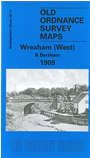
This detailed map covers the western side of Wrexham, with coverage stretching from the cemetery and Wat's Dike westward to Pool Covert and Bersham church, and from Felin Puleston northward to Croes-newydd. Features include Puleston Mills, Esless Mills, Esless Hall, Turkey paper mills, Ddol, Bunkers Hill, Bersham Mills, stretches of railway with engine shed, Croes-newydd South and West Junctions, Moss Valley Junction, fever hospital, Workhouse. Although the western fringe of Wrexham is shown, most of the map is rural. On the reverse we include extracts from a contemporary trade directory.
The map links up with Sheets 28.07 New Broughton to the north and 28.12 Wrexham to the east.