Old Ordnance Survey Maps of Stansty & Broughton


We have published more than 2,000 maps in our series of Old Ordnance Survey Map reprints, including a group in Denbighshire / Clwyd. The maps are highly detailed. They are taken from the OS 1:2,500 (or 25 inch) maps and reduced to about 15 inches to the mile. Each covers an area of a mile and a half by a mile. They show streets with individual houses, tram tracks, railway tracks and even signals, factories, wharves and such details as fountains and water troughs. They will provide hours of fascination for historians and genealogists. The maps are neatly folded and each includes a specially written introduction to the area. Maps can be purchased on our On-line Mapshop where further information about titles is given. Or visit The Index Page for a full list to the series and details of Prices.


Here are the details of maps for Stansty & Broughton:

  • Denbighshire Sheet 28.07 New Broughton & Stansty Hall 1909 - published 2007; intro by Derrick Pratt

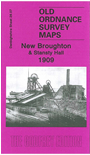
    This detailed map covers the New Broughton area, on the NW side of Wrexham. Coverage stretches from Broughton Colliery eastward to Ashfield House. Features include Broughton Hall, Broughton Colliery, New Broughton Colliery; stretches of the GWR Wrexham & Minera line, GWR Moss Valley Branch and GCR Brymbo Branch; Pentre Broughton Halt, Gatewen Halt, Moss & Pentre station, the village of New Broughton, Higher Berse, Gatewen Colliery, Berse Drelincourt, Highfield, Stansty Hall, western part of racecourse. We include directories of Broughton and Stansty on the reverse.

    The map links up with sheets 28.03 Moss Valley to the north, 28.08 Wrexham North to the east and 28.11 Wrexham West to the south.


    Follow this link for a complete list of our Denbighshire maps.

    You can order maps direct from our On-line Mapshop. For other information and prices, and other areas, go to The Index Page.


    Maps in the Godfrey Edition are taken from the 25 inch to the mile map and reduced to about 15 inches to the mile. For a full list of maps for Wales, return to the Wales page.

    The Godfrey Edition / godfreyedition@btinternet.com / 30 January 2008