Old Ordnance Survey Maps of New Mills (Newtown)


We have published more than 2,400 maps in our series of Old Ordnance Survey Map reprints, including a group in Derbyshire. The maps are highly detailed. They are taken from the OS 1:2,500 (or 25 inch) maps and reduced to about 15 inches to the mile. Each covers an area of a mile and a half by a mile. They show streets with individual houses, tram tracks, railway tracks and even signals, factories, wharves and such details as fountains and water troughs. They will provide hours of fascination for historians and genealogists. The maps are neatly folded and each includes a specially written introduction to the area. Maps can be purchased on our On-line Mapshop or through some local stockists. Visit The Index Page for a full list to the series and details of Prices.


Here are the details of maps for New Mills (Newtown):

  • Derbyshire Sheet 8.02 New Mills (Newtown) 1896 - published 1996; intro by Derek Brumhead & Roger Bryant

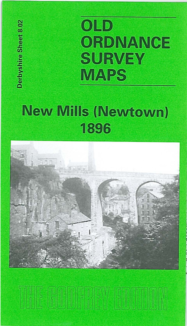
    This detailed map covers parts of Derbyshire and Cheshire. It covers theNewtown area of New Mills, with coverage stretching from Market Street southward to Bankend, and westward to Shady Oak.

    Features include LNWR railway with New Mills station, Sheffield & Midland Jt Railway with station, Torn Top, Peak Forest Canal, Grove Paper Mill, Bankend, Albert Works, Warkmoor Mill, Victoria Mills, Torvale, Higher Waterside, Waterside Mill, Disley Hall (in SW corner), Knathole Wood, Torvale Mill, Rock Mills, Highlee Hall, St Mary's RC Chapel, etc.On the reverse we include a commercial directory.

    The map links up with Derbyshire sheets 5.14 New Mills North to the north, 8.03 Low Leighton to the east and Cheshire sheet 20.15 Higher Disley to the south..


    Follow this link for a complete list of our Derbyshire maps.

    You can order maps direct from our On-line Mapshop. For other information and prices, and other areas, go to The Index Page.


    Maps in the Godfrey Edition are taken from the 25 inch to the mile map and reduced to about 15 inches to the mile. For a full list of maps for England, return to the England page.

    The Godfrey Edition / godfreyedition@btinternet.com / 5 Feb 2010