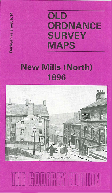
Derbyshire Sheet 5.14 New Mills (North) 1896 - published 1996; intro by Derek Brumhead & Roger Bryant. ISBN.978-0-85054-858-7 
This detailed map covers the North West part of New Mills, with coverage stretching from Meal Street northward to Leaver Castle and westward to Woodend Bridge.
Features include Shaw Marsh, Hague Bar, Brook Bottom, Woodend Mill, Eaves Knoll, Shaw Farm, Whitle, Tanpits Farm, High Lee, Mount Pleasant Chapel, St James church,
Salem Mill, Beardhough, Hidebank etc.
The map links up with Derbyshire sheets 5.15 Birch Vale to the east and 8.02 New Mills Newtown to the south.
Follow this link for a list of our maps for Derbyshire.
You can order maps direct from our On-line Mapshop.
For other information and prices, and other areas, go to The Index Page.
Maps in the Godfrey Edition are taken from the 25 inch to the mile map and reduced to about 15 inches to the mile.
For a full list of maps for England, return to the England page.
Alan Godfrey Maps, Prospect Business Park, Leadgate, Consett, Co Durham, DH8 7PW / sales@alangodfreymaps.co.uk / 25 November 2016
 Here are the details of maps for New Mills (NW):