 Old Ordnance Survey Maps for CarmarthenshireOld Ordnance Survey Maps for Carmarthenshire
 These are our maps for Carmarthenshire:
All maps are available from our On-line Mapshop or from selected bookshops in the area.
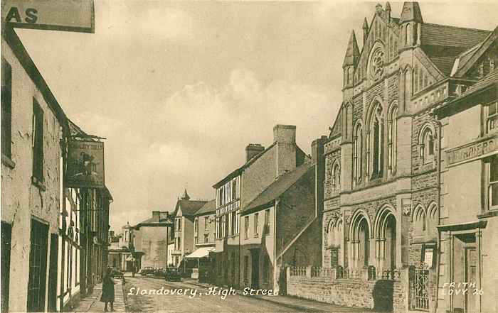
The following maps are taken from the OS 25" maps and reduced to a scale of approximately 15 inches to the mile. They are extremely detailed, showing individual houses, details such as railway tracks, pathways, pubs, factories and even minutiae such as fountains and signal posts. Obviously they cover quite a small area, normally a mile by a mile and a half each. Each map includes an introduction. For further details click on the links below:
 These are the detailed maps we publish for Carmarthenshire:
We also cover the whole of Carmarthenshire in our Inch to the Mile series. These are the principal sheets for the county:
 230 Ammanford & District 1908 - published 2006; intro by Derrick Pratt
Visit the One Inch page for a full list of this series.
