
 Here is information about Sheet 212:
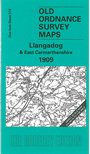
This Inch to the Mile map covers the eastern area of Carmarthenshire around Llangadock (or Llangadog) and Llandovery. Coverage stretches from Brechfa eastward to Myddfai and Llandovery, and from Cilycwm southward to Llandilo (or Llandeilo). The Vale of Towy meanders through the map. On the back we include a section of Carmarthenshire Sheet 26.15 showing Llangadog itself in more detail.
It is not possible to list the many hamlets, farmsteads and other topographical features shown on these maps. However, you may find it useful if we list the towns and principal villages or church parishes that are included on this map:
Index maps are available showing the areas covered by the Inch to the Mile maps. Go to This page
You can order maps direct from our On-line Mapshop. For a full list of Inch to the Mile maps go to the Inch to the Mile page, where you will also find details of prices. For information on the rest of the series, go to The Index Page.