
 Here is information about Sheet 229:
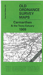
This Inch to the Mile map covers the SW area of Carmarthenshire around the Towy Estuary and Carmarthen. Coverage stretches from Pendine eastward to Llanddarog and Pont-y-Berem, and from Mydrim and Carmarthen southward to Kidwelly, the Gwendraeth estuary, and Mynydd Pembrey. On the reverse we include extracts from Carmarthenshire Sheets 39.03 and 39.07, giving a more detailed picture of the centre of Carmarthen itself, including station, Guildhall Square, King Street, Priory Street, Grammar School etc.
It is not possible to list the many hamlets, farmsteads and other topographical features shown on these maps. However, you may find it useful if we list the towns and principal villages or church parishes that are included on this map:
Index maps are available showing the areas covered by the Inch to the Mile maps. Go to This page
You can order maps direct from our On-line Mapshop. For a full list of Inch to the Mile maps go to the Inch to the Mile page, where you will also find details of prices. For information on the rest of the series, go to The Index Page.