
 Here are the details of maps for Canning Town:

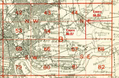
The three versions of this map show how the area developed across the years. The maps each cover the same area, stretching from St Luke's Square and Forty Acre Lane eastward to Leyes Road and beyond, from Wanlip Road southward to Victoria Dock Road. The latter road runs along the lower portion of the map, including the northern tip of Royal Victoria Dock, with many railway sidings etc. The western half of the map is built up with the eastern part of Canning Town; by contrast the map is largely empty undeveloped east of Prince Regents Lane. Features include Plaistow Marsh, GER Woolwich Branch, incl Custom House station, Hudsons Ward, Tidal Basin Ward, Custom House Sports Ground, tramways. Streets include Beckton Road, Denmark Street, Freemasons Road and many others. Note that part of Canning Town is on sheet 65 to the west. All the maps include directory extracts.
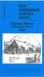
The 1867 map shows the area at a very early stage of development, with scarcely a sign of Canning Town's movement east. The Victoria Dock has been built and Tidal Basin and Custom House stations are open, but to the north and east of them is marshland.
The map links up with Sheet 54 Plaistow to the north, 65 Poplar to the west, 67 Beckton to the east, 80 Silvertown to the south.
 Follow this link for a complete list of our London maps .