
Old Ordnance Survey Maps of London
These detailed maps maps normally cover an area of about one and a half miles by one mile. Each map includes an introduction. The London maps link up with those for Middlesex to form a major series for the Greater London area. They
are available through our On-line Mapshop
 Here are the details of maps for Stockwell & Camberwell:
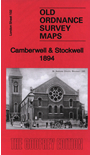
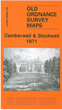
London Sheet 102.1 Camberwell & Stockwell 1871 - published 2006; intro by Pamela Taylor. ISBN.978-1-84151-914-2  London Sheet 102.2 Camberwell & Stockwell 1894 - published 2015; intro by Pamela Taylor. ISBN.978-1-84784-885-7
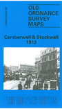
London Sheet 102.3 Camberwell & Stockwell 1913 - published 1990; intro by W W Marshall. ISBN.978-0-85054-370-4
London Sheet 102.2 Camberwell & Stockwell 1894 - published 2015; intro by Pamela Taylor. ISBN.978-1-84784-885-7
London Sheet 102.3 Camberwell & Stockwell 1913 - published 1990; intro by W W Marshall. ISBN.978-0-85054-370-4
We have published 3 maps here, showing how the area developed across the years. Each covers an
area of a mile by a mile and a half, stretching from South Lambeth Road and Stockwell station eastward to Camberwell Green; from
Vassall Road and Albert Square southward to Loughborough Junction. The map therefore covers much of Stockwell, together with the western part of
the vast Camberwell parish; it also covers part of north Brixton.
Even in 1871 this area was very built up, the only undeveloped area being around Knatchbull Road where St James's church stands in some isolation.
As ever, this 1st Edition map is especially attractive, many of the houses around Angel Town, North Brixton and west Camberwell being portrayed with their leafy gardens. On the reverse we include directory entries for
Camberwell Green, Camberwell New Rd, Stockwell Green, Cold Harbour Lane.
The 1894 and 1913 maps covers the same area at a later stage. Features include Kings College Hospital, Angell Town, Ruskin Park, tramways and
tramway depot, Camberwell New Road and Loughborough Junction stations, railway works at Stockwell, South Western Hospital, Myatts Fields. The
countless streets include Stockwell Road, Stockwell Park Road, Brixton Road, Wiltshire Road, Cormont Road, Flaxman Road, Camberwell New Road, Denmark
Hill, and scores more. The maps include extracts from contemporary street directories.
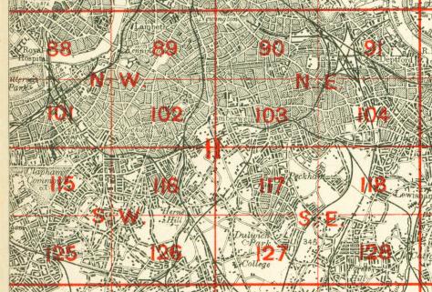
The map links up with Sheets 89 Kennington to the north, 101 Battersea & Clapham to the west, 103 Peckham to the east, 116 Brixton
to the south.
 Follow this link for a complete list of our London maps .
You can order maps direct from our On-line Mapshop.
For other information and prices, and other areas, go to The Index Page.
Follow this link for a complete list of our London maps .
You can order maps direct from our On-line Mapshop.
For other information and prices, and other areas, go to The Index Page.
Maps in the Godfrey Edition are taken from the 25 inch to the mile map and reduced to about 15 inches to the mile.
For a full list of maps for England, return to the England page.
Alan Godfrey Maps, Prospect Business Park, Leadgate, Consett, Co Durham, DH8 7PW / sales@alangodfreymaps.co.uk / 18 February 2018
 Follow this link for a complete list of our London maps .