
 Here are the details of maps for Brockley:

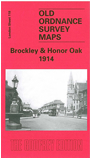
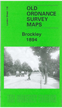
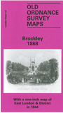
The three versions of this map show how the area developed across the years, becoming more built up. The maps each cover the same area, stretching from Homestall Road and Ryehill Park eastward to Chudleigh Road and Hilly Fields; from Brockley station southward to Honor Oak Park station. Features include Brockley Hall, Crofton Park station, Bermondsey Institution, Nunhead Cemetery, Deptford Cemetery, Ladywell Cemetery, tramways, Oak of Honor Hill, a section of the Crystal Palace railway, Newlands. Churches include St Augustine's, St Silas Athenlay Road. The 1868 map is very open, with little development apart from cemeteries. Much more building by 1914 when roads include Breakspears Rd, Adelaide Rd, Brockley Rd, Ivydale Rd. The 1868 map includes on the reverse an Inch to the Mile map of East London in 1844, stretching from The Tower eastward to Grays, from Romford southward to Dartford. The 1914 map has extracts from a contemporary street directory.
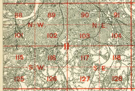
The map links up with Sheets 104 New Cross to the north, 117 East Dulwich to the west, 119 Lewisham to the east and 128 Forest Hill to the south.
 Follow this link for a complete list of our London maps .