Old Ordnance Survey Maps of Forest Hill & Catford


We have published more than 1,800 maps in our series of Old Ordnance Survey Map reprints, some 300 of them in the London area. The maps are highly detailed. They are taken from the OS 1:2,500 (or 25 inch) maps and reduced to about 15 inches to the mile. They show streets with individual houses, tram tracks, railway tracks and even signals, factories, wharves and such details as fountains and water troughs. They will provide hours of fascination for historians and genealogists. The maps are neatly folded and each includes a specially written introduction to the area. Maps can be purchased on our On-line Mapshop where further information about titles is given. For other information and Prices, see Index Page.


Here are the details of maps for Forest Hill & Catford:

  • London Sheet 128.2 Forest Hill & Catford Bridge 1894 - published 2005; introduction by Alan Godfrey
  • London Sheet 128.3 Forest Hill 1914 - published 1991; intro by Adrian Prockter

    We have published two versions of this map, showing how the area developed across the years. The maps each cover the same area, stretching from Honor Oak Road and Dartmouth Road eastward to Nelgarde Road and Berlin Road. The west side of the map covers the Forest Hill area, around and including the station, extending north to the south side of Honor Oak Park station. On the east side of the map are Catford and Catford Bridge stations, St Dunstan's College and Ladywell Recreation Ground. Stanstead Road runs between the two areas, and to the north of this are Brockley Rise, Brockley Hill and Ravensbourne Park. The various churches - Christ Church, St George's, St Saviour's Brockley Rise, St Paul's - reflect the development of the estates. Tramways run through the map. Fragments of the old canal can be found. There are street directory extracts on both maps.

    An index map showing the areas covered by this and adjacent maps is available here. 
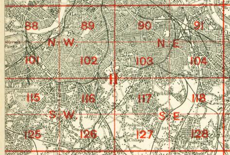
The map links up with London Sheets 118 Brockley to the north, 127 Dulwich Village to the west, 129 Catford to the east, 138 Lower Sydenham to the south.


    Follow this link for a complete list of our London maps .

    You can order maps direct from our On-line Mapshop. For other information and Prices, see Index Page.


    Maps in the Godfrey Edition are taken from the 25 inch to the mile map and reduced to about 15 inches to the mile. For a full list of maps for London, return to the London page

    The Godfrey Edition / godfreyedition@btinternet.com / 31 October 2005