 Here are the details of maps for Hull (East):


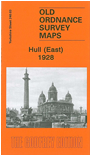
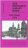
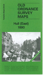
We have published three versions of this detailed map, showing how the area developed across the years. It covers much of central Hull, with coverage stretching from Jameson Street and King Edward Street eastward to Wyke Street. Features include Humber Dock, Prince's Dock, Queen's Dock, Victoria Dock, Garrison Side, Earle's Shipbuilding Yard, The Groves, Victoria Square, Railway Dock, River Hull with many warehouses and dry docks, Southgates station and many railway lines into the docks, tramways, Drypool Square and much of Drypool, timber ponds etc. The 1890 version is colour-porinted, taken from the beautiful 1st Edition handcoloured map. On the reverse of the 1890 and 1908 versions we include selections of street directory entries.
The map links up with Sheets 226.15 Hull NE to the north, 240.02 Hull West to the west and 240.04 Alexandra Dock to the east.