 Here are the details of maps for Hull (NE)

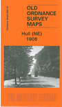
This detailed map covers the busy NE area of Hull, with coverage stretching from Cannon Street station northward to Lorraine Street, and from St Paul's Street eastward to New Bridge Road. Holderness Road runs through the map, as does a winding portion of the River Hull, lined with mills, wharves and factories. Features on the map include stretches of the Hull & Barnsley Railway, the North Eastern Railway incl Wilmington station and goods sheds; tramways, Wilmington, Sulcoates Cemetery, Hull Municipal Hospital (almshouses), Thistleton, cement works, Summergangs, Reckitt's Kingston Works, Wincolmlee Colour Works, the Foredyke Stream, Holderness House, St Mary's church, Cannon Street station and approaches, Stoneferry Canister Works. The many works alongside the railway will fascinate industrial historians, and the map is also noteworthy for its many cramped streets with equally cramped houses. On the reverse we include street directories for Cleveland Street, Cumberland Street, Durham Street, Oxford Street and Swann Street.
The map links up with sheets 226.14 Hull NW to the west, 240.03 Hull East to the south.