Old Ordnance Survey Maps of Leeds

  • These detailed maps normally cover an area of about one and a half miles by one mile. Each map includes an introduction.
  • They are available through our On-line Mapshop

  • Here are the details of maps for Osmondthorpe:

  • Yorkshire Sheet 218.07 Leeds (Osmondthorpe & Neville Hill) 1906 - published 2001; intro by G C Dickinson. 978-1-84151-321-8

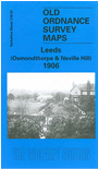
    This detailed map is dominated by the NER's Neville Hill Sidings with engine shed and workshops; the track layout is shown in detail with turntable, signal posts etc. Other features on the map include Osmondthorpe Colliery, Waterloo Main Colliery (Nursery Pit), Westfield, East End Park, Osmondthorpe Hall, Waterloo Main Colliery (Bride Pit). Several lines of he Waterloo Main Colliery Railway are shown, with coal depot. Beyond these is countryside. On the reverse we include a directory of Osmondthorpe Lane, plus a 1908 description of East End Park.


    The map links up with Sheets 218.03 East Leeds to the north, 218.06 South Leeds to the west, 218.11 Thorpe Stapleton to the south and 218.08 Temple Newsam to the east.


  • Follow this link for a complete list of our Bradford or Leeds area maps; or here for the whole Yorkshire series. You can order maps direct from our On-line Mapshop. For other information and prices, and other areas, go to The Index Page.
  • Most maps in the Godfrey Edition are taken from the 25 inch to the mile map and reduced to about 15 inches to the mile.
    For a full list of maps for England, return to the England page.
    Alan Godfrey Maps, Prospect Business Park, Leadgate, Consett, Co Durham, DH8 7PW / sales@alangodfreymaps.co.uk / 19 October 2023