Old Ordnance Survey Maps of Leeds

  • These detailed maps normally cover an area of about one and a half miles by one mile. Each map includes an introduction.
  • They are available through our On-line Mapshop

  • Here are the details of maps for Thwaite Mills:

  • Yorkshire Sheet 218.11 Thorpe Stapleton & Thwaite Mills 1905 - published 2023; intro by Martin Handley. ISBN.978-1-78721-696-9

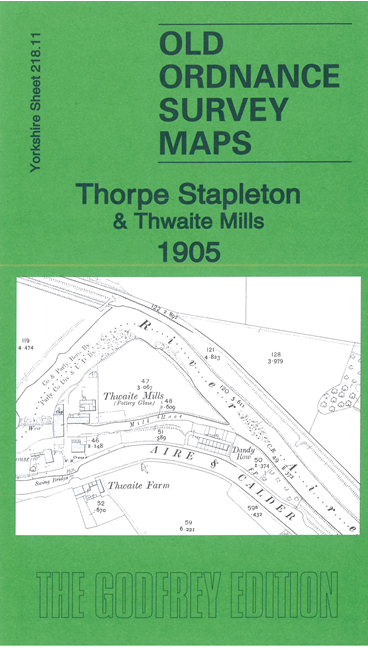
    This detailed map covers an area SE of Leeds that includes Skelton, Thwaite Mills and Thorpe Stapleton.

    Features include Aire & Calder Navigation, Leeds Copper Works, Thwaite Mills, Haigh Park, River Aire, Waterloo Main Colliery (Dam Pit and Park Pits), Thorpe Hall, stretches of railway, Stourton Sidings etc.

    On the reverse we include a section of the OS 1st edition six-inch map covering the area in 1875.


  • The map links up with sheets 218.07 Osmondthorpe to the north, 218.10 Hunslet to the west and 218.15 Rothwell Haigh to the south.
  • Follow this link for a complete list of our Leeds area maps; or here for the whole Yorkshire series. For other information and prices, and other areas, go to The Index Page.
  • Most maps in the Godfrey Edition are taken from the 25 inch to the mile map and reduced to about 15 inches to the mile.
    For a full list of maps for England, return to the England page.
    Alan Godfrey Maps, Prospect Business Park, Leadgate, Consett, Co Durham, DH8 7PW / sales@alangodfreymaps.co.uk / 19 October 2023