
 Here are the details of maps for Drighlington:

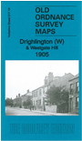
This detailed map covers the western part of Drighlington, with coverage westward to Westgate Hill and to the northern part of Birkenshaw.
Features include Drighlington village centre with St Paul's church, Victoria Hotel, Moorland Mill, Spring Gardens Colliery, tramway, Tong Lane End, New Mill, Old Mill, Shawfield; Westgate Hill with Tong Moor, Cross Lane End, Newmarket Colliery, Lapwater Hall, Old Duke William Inn, Leeming House; and part of Birkenshaw with Threelands, Manor House, Kirkgate Terrace, Moorlands Mill, Moorlands Hall, GNR Gildersome Branch with Birkenshaw & Tong station. We include 1889 directories of Drighlington and Birkenshaw on the reverse.
The map links up with sheet 217.10 Tong to the north, 217.13 East Bierley to the west, 217.15 Gildersome to the east and 232.02 Birkenshaw to the south.