We have very good coverage for Kirklees Metropolitan Borough, which was formed in 1974 from the Dewsbury and Huddersfield County Boroughs, Batley and Spenborough Municipal Boroughs, and Colne Valley, Denby Dale, Heckmondwike, Holmfirth, Kirkburton, Meltham and Mirfield Urban Districts.
The following titles are all taken from the OS 25" maps and reduced to a scale of approximately 14 inches to the mile. Each covers an area of a mile and a half by one mile, and includes an introduction. Click on the links below for further details. All maps are available from our On-line Mapshop.
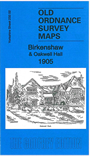 Here are the details of maps for Birkenshaw:

This detailed map covers the centre and southern part of Birkenshaw, with coverage extending south and east to Oakwell Hall.
Features include Oakwell Hall, Fieldhead, Moor Lane House, Breaks Farm, Birkenshaw Bottoms, Highlands, Wasp's Nest, Swincliffe, Clough Mill, The Wheatleys, Springfield House, St Paul's church, Halfway House pub, tramways, Birkenshaw Bottoms Mill, short stretch of LNWR line, GNR Gildersome Branch with Drighlington & Adwalton station, Adwalton Junction, Adwalton Moor. An 1889 directory for Birkenshaw is included on the reverse.
The map links up with sheet 217.14 Drighlington to the north, 232.01 Hunsworth to the west, 232.03 Gildersome Street to the east, 232.06 Gomersal & Birtsall to the south.