Old Ordnance Survey Maps of Leeds

  • These detailed maps normally cover an area of about one and a half miles by one mile. Each map includes an introduction.
  • They are available through our On-line Mapshop

  • Here are the details of maps for Gildersome:

  • Yorks Sheet 217.15 Gildersome 1905 - published 2014; intro by Ruth Strong. ISBN.978-1-84784-760-7

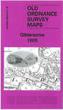
    This detailed map covers the village of Gildersome and extends westward to include part of Adwalton, Cockersdale and Moor Head.

    Features include Gildersome village with individual buildings neatly shown, Hart Hill, Gildersome Windmill, Turton Hall, chapels, Brigg's Pit, St Peter's church, council offices, Moorhead Mill, Nethertown Colliery and tramway, Valley Mills, Nethertown, Lumb Hall, Spring Gardens Colliery (disused), Waterloose Pit (disused), etc. Directories for Gildersome and Adwalton are included on the reverse.


    The map links up with sheet 217.14 Drighlington to the west, 217.11 Farnley Moor Top to the north, 232.03 Gildersome Street to the south.


  • Follow this link for a complete list of our Bradford or Leeds area maps; or here for the whole Yorkshire series. You can order maps direct from our On-line Mapshop. For other information and prices, and other areas, go to The Index Page.
  • Most maps in the Godfrey Edition are taken from the 25 inch to the mile map and reduced to about 15 inches to the mile.
    For a full list of maps for England, return to the England page.
    Alan Godfrey Maps, Prospect Business Park, Leadgate, Consett, Co Durham, DH8 7PW / sales@alangodfreymaps.co.uk / 8th August 2017