 Here are the details of maps for Felling:

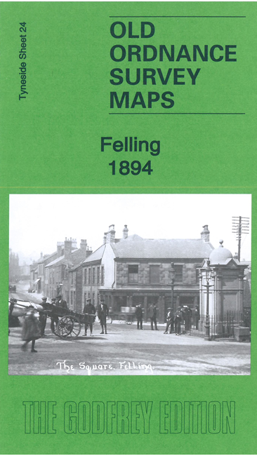
We have published two versions of this map, showing how the area changed across the years.
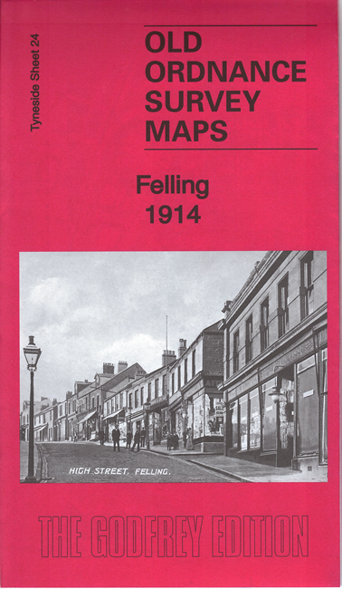
Features include Felling town centre, with individual buildings neatly shown; railway with Felling station, Felling Colliery John Pit, Low Felling, High Felling, Northern Machine Tool Works with railway connection, Crowhall Quarry, Felling Shore Brickworks, tramways, Christ Church, St Patrick's RC church, disused Felling and Carr Hill quarries, Carr Hill area, Deckham Place, Jubilee Children's Hospital, Mount Pleasant, cemetery, Victoria Square etc.
The map links up with Tyneside Sheet 23 Gateshead South to the west, Tyneside Sheet 19 Gateshead East to the north, Durham Sheet 07.05 Gateshead Fell to the south and Durham Sheet 07.02 Heworth to the east.
Maps in the Godfrey Edition are taken from the 25 inch to the mile map and reduced to about 15 inches to the mile. For a full list of maps for the North East, return to the North East page.
The Godfrey Edition / sales@alangodfreymaps.co.uk / 28 April 2023