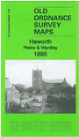
Co Durham Sheet 7.02 Heworth, Pelaw & Wardley 1895 - published 1984, 2nd Edition 2013; intro by Alan Godfrey. ISBN.978-1-84784-700-3 
This very detailed map covers Heworth and extends eastward to Wardley.
Features include Wardley Colliery, South Wardley, site of Wardley Manor, Pontop & Jarrow Railway, Wardley Hall, Lingey House,
NER railway with stretch of Leamside line and Pelaw Junction, Pelaw station (under construction), Heworth village, St Mary's church, Ouston & Pelaw Wagonway, Heworth Lane, Heworth Grange, High Burn Quarry etc. On the reverse we
include 1894 and 1906 directories for Heworth and Wardley.
The map links up with Tyneside sheet 19a St Anthonys to the north and 24 Felling to the west.
Follow this link for a complete list of our Gateshead maps.
You can order maps direct from our On-line Mapshop.
For other information and prices, and other areas, go to The Index Page.
Maps in the Godfrey Edition are taken from the 25 inch to the mile map and reduced to about 15 inches to the mile.
For a full list of maps for England, return to the England page.
Alan Godfrey Maps, Prospect Business Park, Leadgate, Consett, Co Durham, DH8 7PW / sales@alangodfreymaps.co.uk / 14 January 2018
 Here are the details of maps for Heworth: