Old Ordnance Survey Maps of Staffordshire

  • These detailed maps normally cover an area of about one and a half miles by one mile. Each map includes an introduction.
  • They are available through our On-line Mapshop

  • Here are the details of maps for Trentham:

  • Staffordshire Sheet 18.13 Trentham 1924 - published 2009; intro by Malcolm Nixon. ISBN.978-1-84784-260-2

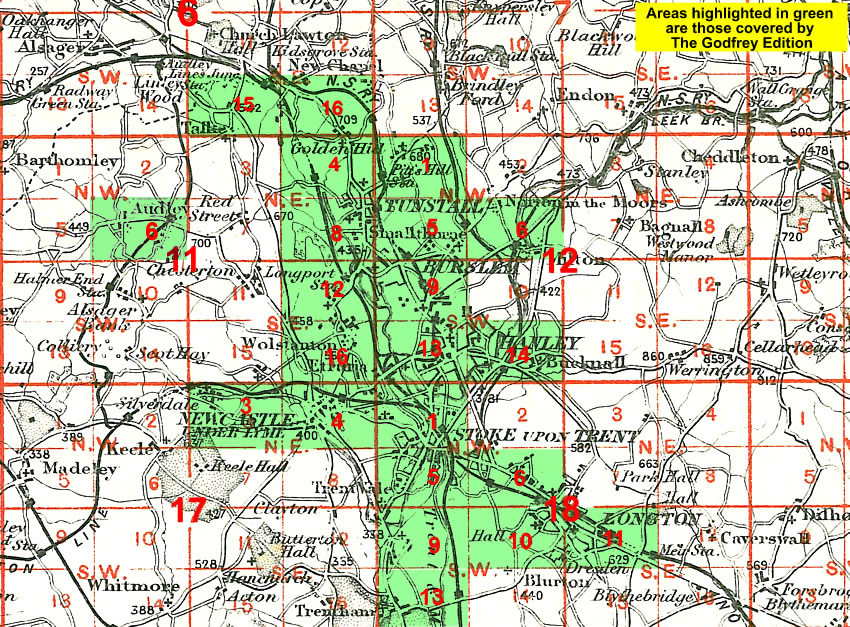
    This map covers the village of Trentham, at the southern end of the Potteries. By 1924 Trentham Hall had been demolished but the map includes much of interest, including the Trentham Gardens & Pleasure Grounds, village and Hemheath.

    Features include St Mary & All Saints church, Trentham Gardens, railway including Trentham Junction station, Trentham Park Branch with Trentham Park station, New Inn Mills, Trentham Hotel, Trent & Mersey Canal, Turbine Farm, New Inn Lane etc. On the reverse we include a 1912 directory of Trentham.

    The map links up with sheet 18.09 Trent Vale to the north.

    You might find this Index Map useful.


  • For a full list of maps of Staffordshire, please go to the Staffordshire page or the Potteries page.
  • You can order maps direct from our On-line Mapshop. For other information and prices, and other areas, go to The Index Page.
  • Maps in the Godfrey Edition are taken from the 25 inch to the mile map and reduced to about 15 inches to the mile. For a full list of maps for England, return to the England page.
    Alan Godfrey Maps, Prospect Business Park, Leadgate, Consett, Co Durham, DH8 7PW / sales@alangodfreymaps.co.uk / 28 January 2018