
 Here are the details of maps for north Burslem:

We have published 2 versions of this map, showing how the area changed across the years. Each covers the eastern edge of Tunstall and northern part of Burslem, including Smallthorne and Bradeley.
The many features include NSR Potteries Loop Line with Tunstall station, NSR Tunstall Branch, Pinnox Sidings, electricity works, tramways, Tunstall Park, Globe Pottery, Scotia Bank Works, Bycars Brick & Pipe Works, Burslem Park, St Werburga's church, Stanfield Sanatorium, Nettlebank Wharf, Bank Top, Smallthorne area, St Saviour's church, cemetery, Old Council Offices, old collieries, Bradeley area etc. The 1898 version includes an 1892 directory of Smallthorne on the reverse.
The map links up with Staffordshire Sheets 12.01 Great Chell to the north, 11.08 Tunstall to the west, 12.06 Milton (North) to the east and 12.09 Burslem to the south.
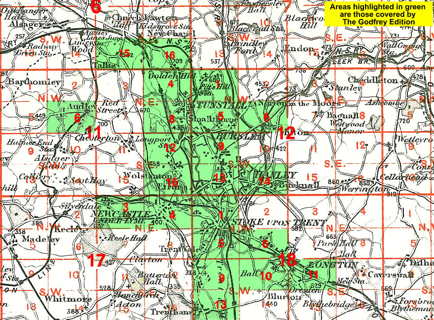
You might find this Index Map useful.