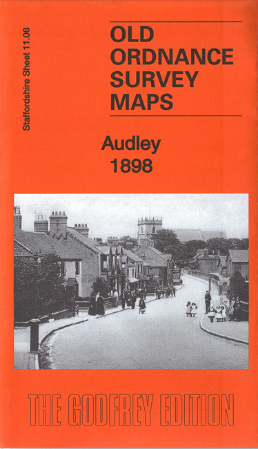
Staffordshire Sheet 11.06 Audley 1898 - published 2016; intro by Malcolm Nixon. ISBN.978-1-84784-992-2 
This detailed map covers the village of Audley and extends eastward to Audley Colliery.
Features include Audley Colliery, Butters Green, Diglake Junction, Audley station, Boon Hill, Boyles Hall Colliery, Raven's Lane, Boyles Hall, Wereton, Wall Farm, Hougher Wall, St James church,
Townhouse etc. A 1912 directory of Audley is included on the reverse.
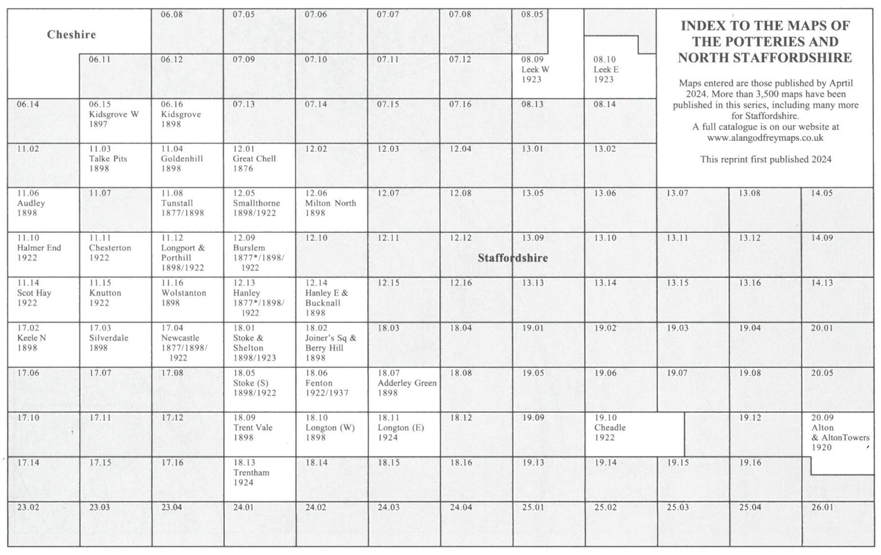
You might find this Index Map useful.
The maps links up with sheet 11.10 Halmer End to the south.
For a full list of maps of Staffordshire, please go to the Staffordshire page or the
Potteries page. For other information and prices, and other areas, go to The Index Page.
Maps in the Godfrey Edition are taken from the 25 inch to the mile map and reduced to about 15 inches to the mile.
For a full list of maps for England, return to the England page.
Alan Godfrey Maps, Prospect Business Park, Leadgate, Consett, Co Durham, DH8 7PW /
sales@alangodfreymaps.co.uk / 8 March 2023

 Here are the details of the map for Audley: