Old Ordnance Survey Maps of Linlithgowshire

  • These detailed maps normally cover an area of about one and a half miles by one mile. Each map includes an introduction.
  • They are available through our On-line Mapshop

  • Here are the details of maps for Queensferry:

  • Linlithgowshire Sheet 2.16 Queensferry & Dalmeny 1895 - published 1995; intro by William F Hendrie. ISBN.978-0-85054-765-8

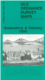
    This detailed map is double-sided for maximum coverage. The main map covers the village of Queensferry (or South Queensferry), with coverage westward to Inchgarvie. Features include Echline, NBR South Queensferry Branch, part of Port Edgar, goods station, harbour, High Street with individual buildings shown, etc.

    On the reverse we include about half of adjacent sheet 3.13 covering the eastern part of Queensferry, approaches and southern part of Forth Bridge, Dalmeny station, Dalmeny village.


  • Follow this link for a complete list of our Linlithgowshire maps.
  • You can order maps direct from our On-line Mapshop. For other information and prices, and other areas, go to The Index Page.
  • Maps in the Godfrey Edition are taken from the 25 inch to the mile map and reduced to about 15 inches to the mile. For a full list of maps for Scotland, return to the Scotland page.
    The Godfrey Edition / sales@alangodfreymaps.co.uk / 5 Nov 2016