
 Here is information about the map for Heston:

We have published two versions of this map, showing how the area changed over the years.
The 1894 map shows Heston as a rural Middlesex village, surrounded by orchards or market gardens, and with open countryside to the west. A clutch of roads or lanes - Fern Lane, Norwood Green Road, Smoky Lane, Church Lane - have houses on them, and St Leonard's church, some pubs, Heston Hall, Heston Farm and a few other buildings form the village. To the south is the hamlet of Sutton. Cranford Lane meanders across the map.
The 1935 map is more developed and includes Heston Airfield; scheduled services started here in 1933 with flights to the Isle of Wight; Chamberlain famously flew from here to meet Hitler. This map includes a 1933 directory of Heston.
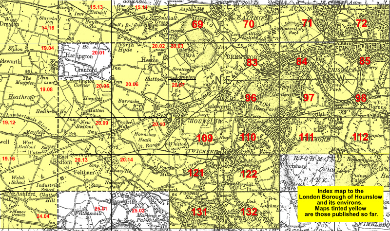
The map links up with Middlesex Sheets 15.14 Southall Green to the north, 20.01 Harlington to the west, 20.03 Osterley Park to the east, 20.06 Hounslow Westto the south.
 Follow this link for a list of our maps for the London Borough of Hounslow, or here for a complete list of our London maps .