
Old Ordnance Survey Maps of Halton
This is our coverage of the Borough of Halton. The Borough of Halton was created in 1974, combining the Borough of Widnes
in Lancashire with Runcorn Urban District in Cheshire, together with some neighbouring parishes. It became a unitary authority in 1998. Though it straddles the Mersey, it is in Cheshire for
ceremonial purposes but since 2014 has strengthened its ties with Merseyside as a member of the Liverpool City Region Combined Authority.
All maps are available from our On-line Mapshop.
The following titles are all taken from the OS 25" maps and reduced to a scale of approximately 14 inches to the mile.
 The following maps are in our Lancashire series:
Lancs 115.09a Widnes 1891 - published 2020; intro by Alan Godfrey
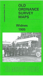
Lancs 115.09b Widnes 1905 - published 1995, 2nd Edition 2002; intro by Mike Greatbatch
Lancs 115.13a Runcorn 1894 - published 2020; intro by Alan Godfrey  Lancs 115.13b Runcorn 1905 - published 1989; intro by Mike Greatbatch
The following maps are in our Cheshire series:
Cheshire 24.03 Runcorn 1937 - published 2023; intro by Alan Godfrey
Cheshire 24.04 Halton Castle & East Runcorn 1935 - published 2023; intro by Alan Godfrey
The area is also covered in our Inch to the Mile series. The principal sheet is:
97 The Lower Mersey, Runcorn & Warrington 1913 - published 2005; intro by Alan Crosby. Includes a large scale map of Preston Brook
 Most maps in the Godfrey Edition are taken from the 25 inch to the mile map and reduced to about 15 inches to the mile.
For a full list of Lancashire and Cheshire maps, go to the North West page
You can order maps direct from our On-line Mapshop.
Most maps in the Godfrey Edition are taken from the 25 inch to the mile map and reduced to about 15 inches to the mile.
For a full list of Lancashire and Cheshire maps, go to the North West page
You can order maps direct from our On-line Mapshop.
Alan Godfrey Maps, Prospect Business Park, Leadgate, Consett, DH8 7PW. Tel 01207 583388
The Godfrey Edition / sales@alangodfreymaps.co.uk / 1 November 2023