 Here are the details of maps for Boldon Colliery:

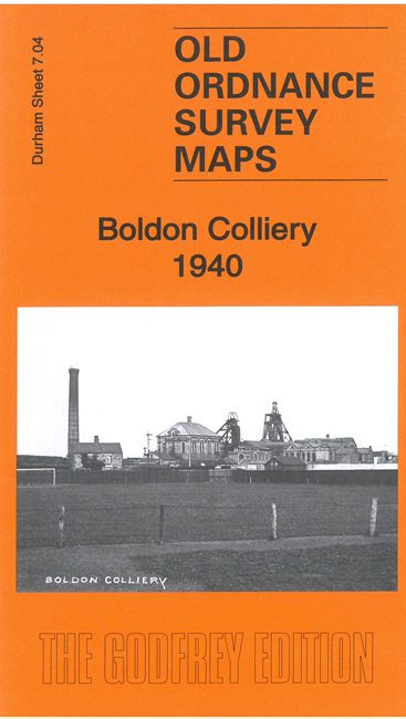
This detailed map covers the village of Boldon Colliery and part of West Boldon.
Features include Boldon Colliery itself, the Pontop & South Shields Railway, St Nicholas church, miners hall and other buildings, LNER Boldon Branch, Coronation Park, Harden Farm, schools, St Nicholas church West Boldon, etc
This map links up with Durham Sheet 13.16 Brockley Whins to the north, and Sheet 8.01 East Boldon to the east.
Maps in the Godfrey Edition are taken from the 25 inch to the mile map and reduced to about 15 inches to the mile. For a full list of maps for the North East, return to the North East page.
The Godfrey Edition / sales@alangodfreymaps.co.uk / 23 March 2023