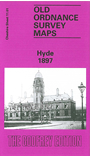
 Here are the details of maps for Hyde:

This detailed map is double-side for maximum coverage and actually includes sheet 11.01 and 11.05. Please note that in this edition the Lancashire area west of the River Tame is left blank.
The busiest of the maps is sheet 11.01 which covers the town centre of Hyde. Coverage here stretches from the Tame eastward to Cheapside and Lumn Street, and from St Stephen's church southward to Syddall Street. Features include Town Hall and Market, Peacock Coal Pit (disused), Millwood Mill, boiler works, Birch House, Slack Mills, Hyde Hall, engineering works, Newtonbank Bleach Works, Hoviley Bridge (at east margin of map), Godley Brook, Carrfield Mill, Bayleyfield Mill, Hyde station, Floweryfield, Canal Iron Works, Kingston, Barnfield Mill, coal pit, Broomstair Bridge, Throstle Bank Mill, Floweyfield House etc. Sheet 11.05 on the reverse continues coverage southward towards Trianon Mill and Apethorn Junction. Features here include Apethorn Mill, Gibraltar Mill, Providence Mill, St George's church, Apethorn Lane, etc.
This map links up with Cheshire sheets 3.13 Hyde to the north and 11.09 Woodley to the south.
Hyde is also covered in our Lancashire series, sheet 112.03. See this page.