We have very good coverage for Kirklees Metropolitan Borough, which was formed in 1974 from the Dewsbury and Huddersfield County Boroughs, Batley and Spenborough Municipal Boroughs, and Colne Valley, Denby Dale, Heckmondwike, Holmfirth, Kirkburton, Meltham and Mirfield Urban Districts.
The following titles are all taken from the OS 25" maps and reduced to a scale of approximately 14 inches to the mile. Each covers an area of a mile and a half by one mile, and includes an introduction. Click on the links below for further details. All maps are available from our On-line Mapshop.
 Here are the details of maps for Mirfield:

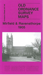
This detailed map covers the central and eastern part of Mirfield, plus much of Ravensthorpe. Coverage extends from Mirfield station eastward to St Saviour's church Ravensthorpe, and from St Mary's church Mirfield southward to Hopton Bottom. Features include the railway with Mirfield station, Cleckheaton Junction, goods shed; Calder & Hebble Navigation with Shepley Bridge Cut, Greenwood Cut, Ledgard Bridge Dock Yard; St Mary's church, Blake Hall, East-thorpe Villa, South Brook Mill, Holme Bank Mills, River Calder, malthouses, Memorial Hospital, Ivy Lodge, Marma Villa at Mirfield; Low Mills, Oakland Mills, Netherfield Mill, Ravensthorpe Mills, Netherfield House (UDC Offices), St Saviour's church at Ravensthorpe; Sands House, Cotewall, Calder Farm Reformatory, Calder New Pit south of the Calder. On the reverse we include a directory of Mirfield listing private residents in 1889.
The map links up with Sheet 247.02 Mirfield NE to the north, 247.05 Mirfield SW to the west and 247.07 Thornhill Lees to the east