Old Ordnance Survey Maps of Bolton Woods


We have published more than 2,000 maps in our series of Old Ordnance Survey Map reprints, including a group for the Yorkshire area. The maps are highly detailed. They are taken from the OS 1:2,500 (or 25 inch) maps and reduced to about 15 inches to the mile. Each covers an area of a mile and a half by a mile. They show streets with individual houses, tram tracks, railway tracks and even signals, factories, wharves and such details as fountains and water troughs. They will provide hours of fascination for historians and genealogists. The maps are neatly folded and each includes a specially written introduction to the area. Maps can be purchased on our On-line Mapshop where further information about titles is given. Or visit The Index Page for a full list to the series and details of Prices.


Here are the details of maps for Bradford (Bolton Woods):

  • Yorkshire Sheet 201.16 Bradford (Bolton Woods) 1906 - published 2001; introduction by Gordon Dickinson

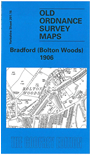
    This detailed map covers the Bolton Woods area of north Bradford. Coverage stretches from Frizinghall Works eastward to Bolton Outlanes, and from Owlet Hall at Gaisby southward to Low Fold and Lister Lane. Features include Dumb Mill Place, Frizinghall Grease Works, Bolton Wood Quarries, Frizinghall Chemical Works, Midland Railway with track layout, Frizinghall station, Manningham Sidings, engine shed, Clock House, eastern part of Lister Park, Hollin Close, Hodgson's Fold, Walnut Farm, Bolton Grange, St James church, Grove House, tramways , Idle Road. On the reverse we include street directory entries for Bolton Hall Road, Canal Road, Cunliffe Terrace/Villas, Frizinghall Road, Mexborough Road, Valley Road.


    The map links up with sheets 201.15 Frizinghall to the west, 216.04 Bradford North to the south.


    Follow this link for a complete list of our Bradford and Leedsarea maps; or here for the whole Yorkshire series.

    You can order maps direct from our On-line Mapshop. For other information and prices, and other areas, go to The Index Page.


    Maps in the Godfrey Edition are taken from the 25 inch to the mile map and reduced to about 15 inches to the mile. For a full list of maps for England, return to the England page.

    Alan Godfrey Maps, Prospect Business Park, Leadgate, Consett, Co Durham, DH8 7PW / godfreyedition@btinternet.com / 26 June 2007